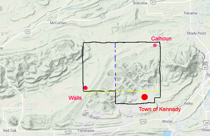
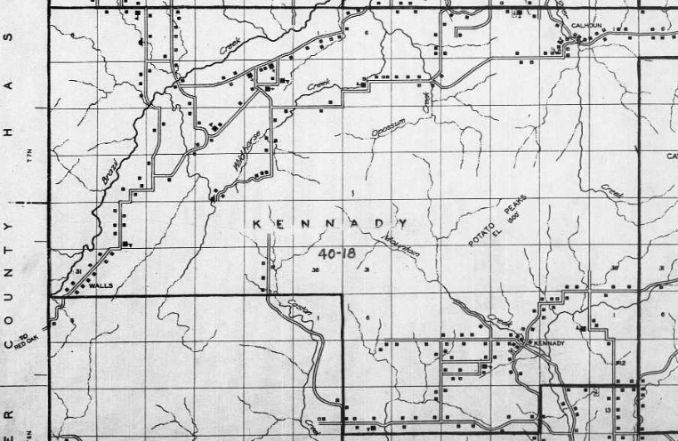
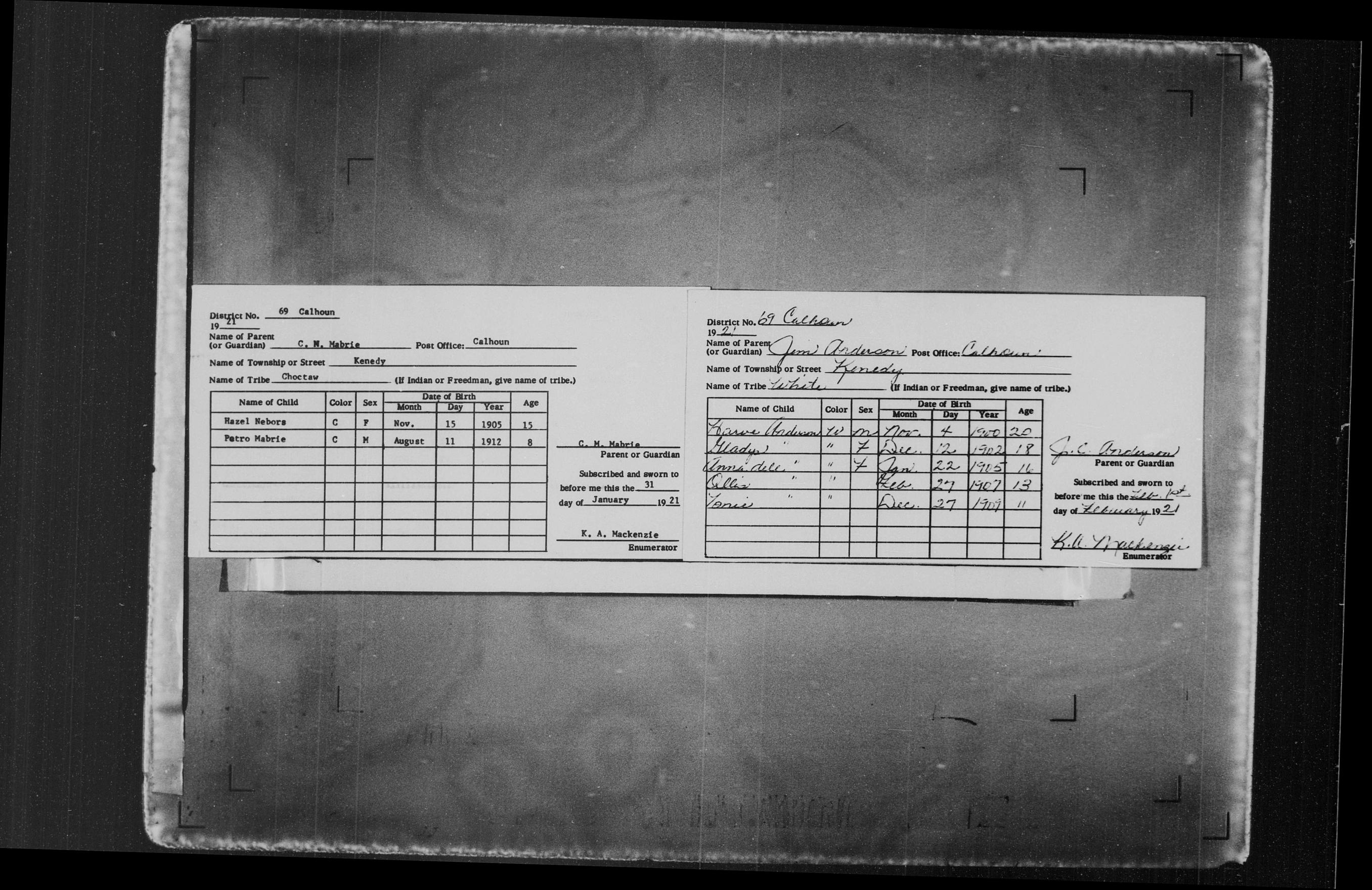
This answer is an overview of the 1920 Census microfilms and aids for using the census, using your missing ED as a case study. It will cover some of the resources you've already consulted for your question -- consider this a checklist to make sure there aren't resources or techniques that you have overlooked. This is also to make the answer more useful to other people who might have the same problem for other geographical areas.
My experience is that, except for a handful of well-known cases where schedules were lost, it's difficult to find out whether or not a particular geographical area was skipped during enumeration or during microfilming. What does happen sometimes is that websites like Ancestry will re-arrange the digital images, making it even more difficult to find a specific location or family if you are 'walking through' the microfilm. Whenever I get stuck and can't find what I'm looking for, I go back to the very beginning and review all the available resources.
Step 1: Go to the original repository and see what guides exist for the records you are looking at.
The US National Archives and Records Administration (NARA) has put many of their guides to Federal Records and portions of the microfilm catalog online. We don't need to order the microfilm itself these days because we can find it online, but we can still use the guides and finding aids. For the 1920 Census, the online guide starts here: 1920 Federal Population Census - Microfilm Catalog - Part 1
Many NARA microcopy publications have descriptive pamphlets (DPs) which describe the records. Some are simply the roll lists from the microfilm catalog. Some have descriptions written by the archivists that alert the user to problems such as records being filmed backwards or out of order. We know from the online guide linked above that the 1920 Census is NARA microfim publication T625. To get the DP, go to the online ordering at https://eservices.archives.gov/orderonline/. You'll be redirected to a screen that looks like this:
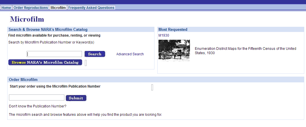
You can either use the keyword search in the upper box to look for "1920 Census" or type in "T625" in the lower box. After that, you'll get a list of subsets for T625 available for ordering. Pick one, and look for the box on the right-hand side of the screen with the PDF icon:
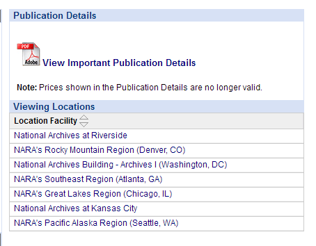
Click on the link View Important Publication Details to download the PDF (in this example, T625.pdf).
Part one of the online guide lists the following for Oklahoma: (see note below the quote).
Counties: Adair, Alfalfa, Atoka, Beaver, Blaine, Bryan, Canadian,
Carter, Cimarron, Cotton, Creek, Delaware, Garvin, Grady, Grant,
Harper, Haskell, Johnston, Kay, Kingfisher, Kiowa, Lincoln, Love,
Major, Marshall, Mayes, McCurtain, McIntosh, Murray, Muskogee, Noble,
Okfuskee, Okmulgee, Osage, Ottawa, Pittsburg, Pontotoc, Pottawatomie,
Pushmataha, Sequoyah, Texas, Tillman, Tulsa, Wagoner, Washita, Woods,
Woodward
Townships and Cities: Ardmore, Chickasha, Enid, Guthrie, McAlester,
Muskogee, Oklahoma City, Okmulgee, Sapula, Shawnee, Tulsa, Waurika
Your target county, Le Flore County, is not in this list, nor is Kennady in the list of separate townships and cities. Added note: this part of the online guide refers to the available ED maps, not the census schedules.
To double-check what's going on, first I turned to the interactive website for the Atlas of Historical County Boundaries at the Newberry Library and checked their county chronologies:
LE FLORE
16 Nov 1907 LE FLORE created from former Indian Territory. (Okla.
Constitution [1907], art. 17, sec. 8; Swindler, 8:148)
From this we see that Le Flore did exist and there should be population schedules we can look at, even if there is no map. Let's check the DP for T625. From the DP, we learn:
- The original schedules no longer exist, so the microfilm is all we have.
- Le Flore county is in the list on roll 1468. Note how the EDs are not in order.

I repeat this process whenever necessary, getting the DP for any NARA Microcopy publication I use in my research.
Step 2: Consult other research guides
NARA's guide tells us how people were supposed to be enumerated:
Individuals were enumerated as residents of the place in which they
regularly slept, not where they worked or might be visiting. People
with no regular residence, including "floaters" and members of
transient railroad or construction camps, were enumerated as residents
of the place where they were when the enumeration was taken.
Enumerators were also to ask if any family members were temporarily
absent; if so, these were to be listed either with the household or on
the last schedule for the census subdivision. Thus, the user should
always check that page. The answers that appear on the microfilmed
schedules depend upon what the enumerator recorded and what the people
interviewed told the enumerator.
Researchers who want more details can get the enumerators' instructions online, via the US Census Bureau's website, sites like Google Books, or a 'good parts version' at IPUMS USA: 1920 Census: Instructions to Enumerators.
NARA's online guides, which were created from their published works, are quite extensive, but they aren't always up to the minute about what's available online. More material is being added online at such a rate that even NARA's list of Microfilm Publications and Original Records Digitized by Our Digitization Partners isn't necessarily up to date.
Another important source of information is the FamilySearch Wiki. A list of the articles consulted is at the bottom of this answer. (For any record you access on FamilySearch, from the Search page, click the "Learn More" link to take you to an article about the records you are searching.)
Maps
Enumeration district maps are on NARA microcopy publication A3378 and are available at FamilySearch. NARA's DP A3378.pdf, written by now-senior archivist and project manager Claire Kluskens, gives background information and discusses coverage issues:
The maps reproduced in this microfilm publication are arranged
alphabetically by state, then by county, then by census year, then by
local jurisdiction. As noted above, however, there are gaps in
coverage. Although most counties are included, not all census years
for a given county may be included. Coverage is most complete for the
1930 and 1940 censuses. This undoubtedly indicates that the Bureau’s
collection of maps for the 1930 and 1940 censuses was more extensive
than for the 1900–1920 censuses.
(If you have to use a later map for your target ED, Steven P. Morse's One-Step Web Pages has a converter that will put you in the right ED. See the Resources section at the end of the article.)
Roll 49, Oklahoma, Adair-Pushmataha 1900-1940, has 1015 images. I haven't been able to locate Le Flore County yet, so it may be that there is no map for 1920. The link is at the end of the answer.
ED Descriptions
My copy of the DP for A3378 has a typo -- the Enumeration Districts descriptions are NARA Microcopy publication T1224. (T1234 is Public Land Survey Township Plats, compiled 1789 - 1946, documenting the period 1785 - 1946, available at Ancestry, which may also be useful for your Oklahoma case).
T1224 is available on microfilm at the Family History Library but it has not yet been digitized:
1920, Oklahoma, Oregon Family History Library United States & Canada Census Area FHL 1842716
A search on Worldcat.org only has the listing for the Family History Library.
The DP for T1224.pdf says that for the 1920 Census, descriptions for Oklahoma and Oregon are on Roll 55.
The information on Steve Morse's site comes from Ancestry, and gives the same information you've already found (or in the case of the range and township you want, what you haven't found):
- Year Series Roll State County ED Description
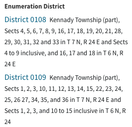
- 1920 T625 1468 OK Le Flore 108 Kennady twp (pt), Sects 4, 5, 6, 7, 8, 9, 16, 17, 18, 19, 20, 21, 28, 29, 30, 31, 32 and 33 in T 7 N, R 24 E and Sects 4 to 9 inclusive, and 16, 17 and 18 in T 6 N, R 24 E
- 1920 T625 1468 OK Le Flore 109 Kennady twp (pt), Sects 1, 2, 3, 10, 11, 12, 13, 14, 15, 22, 23, 24, 25, 26 27, 34, 35, and 36 in T 7 N, R 24 E and Sects 1, 2, 3, and 10 to 15 inclusive in T 6 N, R 24
Now what?
By now you're probably saying "But I already did all that! Now what?"
You've looked at the published descriptions, you've seen the available ED maps, you've looked at all the guides, you've studied the area, and your place is still missing. Try this:
- Go to the Internet Archive (link below) and go through the roll of microfilm. The reason I suggest doing it there is that the Internet Archive is far less likely to rearrange the digital images than Ancestry or FamilySearch.
- Use the Plat maps on NARA T1234 (comparing them to the ED maps) and see what landowners you can find. In other words, map out the positive space to determine the extent of the negative space (what's missing). Use county histories and whatever other resources you can lay hands on to find out who else is missing besides your own family.
- Use the information from your study of landowners to look up the landowners in published census indexes (see Dollarhide's The Census Book for tips on Soundex, Miracode, and using published indexes).
- Use PERSI, Google Scholar, Google Books, Hathi Trust, and the Internet Archive to see if anyone else has written about coverage issues in this county.
- Get help from NARA, either by sending an email to [email protected], or by posting on their site History Hub. Disclaimer: you might not get an archivist answering you on History Hub -- you could get another random person not qualified in Oklahoma research, like the author of this answer.
- Contact the local genealogical society and/or historical society, and search for reference guides at the local public libraries for that geographical area.
- Check the Oklahoma State archives and the major university libraries for finding aids and reference material to see if anyone has discussed coverage issues.
- Look for bloggers, both amateur and professional, who write about Oklahoma genealogy to see if they've written about the problem.
- Consult a professional genealogist to see if they have already investigated the coverage issue. ICAPGen certifies people in specific geographical areas, so their member directory might be a good place to start.
- Read historical newspapers from the period to see what people were talking about at the time the census was taken.
Sometimes the people we want to find in the census are just plain missing, for whatever reason. If all else fails, fill in with any other record type you can, and work inwards towards the 'hole' by starting with what you know and working step by step in time and in space.
It might be possible, if the records survived, for a researcher to ferret out which enumerator was responsible for covering that area, then looking for evidence about whether the area was covered or not, by researching in Record group 29 at NARA -- but that's advanced research, and there's no guarantee the correspondence and reports you would need were turned over to NARA.
Tools:
Microfilms:
- Population Schedules, 1920 Census: T625 Roll 1468 at the InternetArchive
- Enumeration district maps for the twelfth through sixteenth censuses of the United States, Roll 49 Oklahoma Adair – Pushmataha, 1900-1940: A3378 roll 49 of 73 at FamilySearch Warning: roll is filmed back to front
- NARA T1224, Census descriptions of geographic subdivisions and enumeration districts, 1920: FHL 1842702 (not digitized)
- NARA M1582, 1920 Soundex index at the Internet Archive
Census articles at the FamilySearch Wiki:
Note that the FamilySearch Wiki articles generally include citations for the works referenced when the article was written. For any article or book, use the bibliography and references cited as a springboard to further research.
State Research Guides:
For Further Reading:
General resources:
For more examples of mapping out undercounts, see:
